About
Type: Extant
Parish: St.John
Founding date: 1777
See on Google Maps!
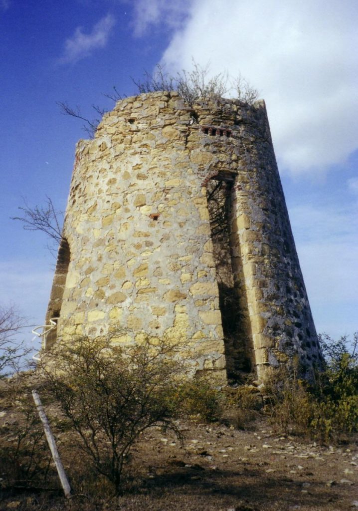
Current Status
Very little is known of this estate. The sugar mill still stands, and the surrounding area on the brow of the hill is littered with cut stone and the foundations of buildings. To the west is a magnificent view towards Five Islands with The Union (#27) directly north. New homes are being constructed below and along the ridge, which affords beautiful views.
Estate Related History/Timeline
In 1787/88 John Otto-Baijer, esq., was the owner of a plantation on Five Islands Division, as well as Denfield’s (#25), Cook’s (#26), Dewitt’s and Otto-Baijer’s (#16). Vere Oliver, Volume I.
George Martin mentioned to this author that he had heard that somewhere on the hill, there is a stone marking a spot where slaves were once hung but was unable to identify the site.
A 1777 map by John Luffman shows an estate he labeled “Domfield,” owned by Otto-Baijer, Esq. It is almost surely a mis-spelling of Denfield’s.
Enslaved People’s History
Based on contemporary research, we have little information to share about the enslaved peoples from this plantation at this time. A fact of interest is that George Martin, the owner since 2000, mentioned to this author that he had heard that somewhere on the hill, there is a stone marking a spot where slaves were once hung but was unable to identify the site. We will continue our quest for more information about these vital individuals.
Ownership Chronology
- 1777: John Otto Baijer, Esq. (Died 1796) (177/78 map by cartographer John Luffman.)
- 1933: Mrs. M. T. Camacho (1933 Camacho map.)
- 1940’s: John I. Martin
- 2000: George Martin