Type: Ruin
Parish: St.Philip
Founding date: 1673
See on Google Maps!


Current Status
There is no longer a mill at this site and very little to show it might once have been occupied. On the south coast there can still be found the remains of an old wall.
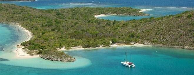
Green Island, on the east coast, now belongs to Mill Reef and is a favourite out island for boating, camping and day trips by members, locals and visitors alike. A fair amount of moorings have been set up around the east and south coast and this is a favourite mooring for sailboats during the tourist season. Harmony Hall also offer a morning and afternoon trip over for a swim which is included upon request with a reservation for lunch.
Estate Related History/ Timeline:
“1673-4 Captain Richard Ayres ….. also a grant of Green Island near Nonsuch.” History of the Island of Antigua by Vere Oliver Vol.I.
In 1921 it contained 100 acres . Cattle were also raised on the island at one time.
See Judge Blizzard’s Vol.I in St. John’s parish for information on Stephen Blizard.
“In the mid 1940’s Walter McSevney (Diamond’s) brought over rabbits to Green Island, which disappeared after the two hurricanes in 1950. We would often camp on the island and would see the rabbits hopping around.” Francis Nunes.
In the 1970’s tourists were coming to Brown’s Bay Resort and Mr. David Edwards of Freetown who was a fisherman with his own 19ft boat, used to carry ten to twelve of them at a time over to Guiana Island. He would buy 1 1/2 gallons of 150 proof Cavalier rum to make up his rum punch and take along a large bowl of salad. He had fish pots set all around the island, so while the guests were swimming and enjoying themselves, he’d pull a few pots, season up the fish and steam them on the fire. The large fish he filleted and the smaller ones he left whole. He said everyone had a good time and thought his lunch wonderful.
“Diffy” Lake, who was the manager at Long Lane loved “his gun,” according to Mr. Edwards, and leased Green Island during the hunting season for his use.
Enslaved People’s History
Based on contemporary research, we have little information to share about the enslaved peoples from this plantation at this time. However, we will continue our quest for more information about these vital individuals.
Ownership Chronology
1673 – 1750: Capt. Richard Ayres
1750: Stephen Blizard (1704-1777)
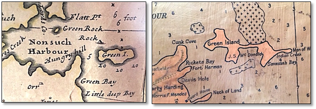
1790: Heirs of Stephen Blizard 1777/78 Luffman map
1851 & 1872: does not appear in the Antigua Almanacs.
1878: Stephen Blizard
1891: James Rocke (d.April 8, 1898) Mr. James Rocke of Antigua, WI. The Colonies & India 13
1921: R. Maginley
1933: J.S. Macdonald 1933 Camacho map.
1947: Mill Reef